Jhomolhari Trek 14night 15days
Mount. Jhomolhari
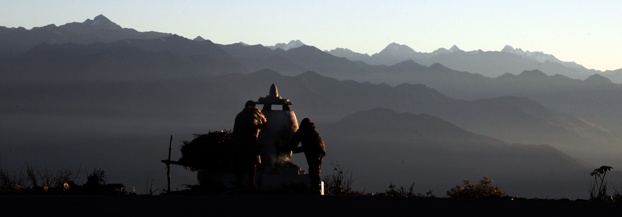
 This is a strenuous 10 days trek, starting from Drukgyel Dzong, Paro and ending at Dodina, Thimphu. This trek is one of the most popular treks in Bhutan, passing through scattered hamlets and farm land into densely forested valleys. It takes us to high alpine pasture land, where yak herders gaze their animals. The trek offers a great variety of landscape and stunning views of the Himalayan peaks. Along the trek route you will see the Blue sheep and many other examples of our wild life.
The trek takes up the Paro Chu (valley) to Jhomolhari base camp over the first three days. The views at the camp are amongst the best in the Himalayas. For those that are carrying on over the 2 high passes we spend a day at base camp to acclimatize and tour the region. Then it is over the first of the high passes – Nyilela pass 4870m (15680ft) an exciting adventure as we continue along a mountain ridge getting fabulous views of the Himalayas up close. We spend the night near a military camp and next day can either be at rest for exploration of the Linjshi valley and Dzong. Its then over the highest pass of the trek at 4930m (16270ft) Yelila pass frequently snow covered. From there it is a 3 day trek down the valley to Thimphu – climbing up to highs as we go. The scenery is sometimes ragged as we cut through deep gorges and always green.
Grade: Moderate
Time: 10 days
Distance 82.5 miles / 133km
Altitude Gain 11, 608ft / 3539m
Altitude Loss 7987ft / 2435m
Status open
Outlined Itinerary
Day Date Day to Day trip schedule Hotel / Camp
Day 1 Arrive Paro & Sightseeing Hotel /
Day 2 Paro Sightseeing Hotel
Day 3 Trek day 1- Start of Trek Paro / Shana Camp
Day 4 Trek Day 2- Shana – Thangthangkha Camp
Day 5 Trek Day 3- Thangthangkha- Jangothang Camp
Day 6 Trek Day 4 -Jangothang – Halt Camp
Day 7 Trek Day 5- Jangothang – Lingshi Camp
Day 8 Trek Day 6- Lingshi – Halt Camp
Day 9 Trek Day 7 – Lingshi – Shodu Camp
Day 10 Trek Day 8 – Shodu – Barshong Camp
Day 11 Trek Day 9 – Barshong – Dolam Khencho Camp
Day 12 Trek Day 10 – Dolam Khencho – Dodina – Thimphu Hotel
Day 13 Thimphu Halt Hotel
Day 14 Thimphu – Paro Hotel
Day 15 Paro – Departure
Detailed Trip Itinerary
Day 1: Arrive / Paro
Fly into Bhutan on Druk Airways. If you are lucky, you will have glorious view of the snowcapped Himalayas. The remarkable and steep descent into the Paro valley is an awe-inspiring beginning to an adventure of a lifetime. After visa formalities and collection of baggage, you will meet the Bhutanese representative from Bhutan Majestic Travel, who will receive you and drive through Paro valley to your hotel. After settling down at the hotel, you will have your lunch. Afternoon visit the National Museum (Tak Dzong) (one of the fine museums in Asia that would shed further light to your adventurous trip to Bhutan and Paro Rimpong Dzong, administration center and religious institute of the valley. This Dzong may be familiar to people who watched Burtolucci’s film “The Little Buddha, followed by walk through Paro town.
Dinner and Overnight: Hotel
Day 2: Paro – Taktsang (Tiger Nest Excursion)
After breakfast we drive to the north of Paro valley to Ramthangkha, from where we start our hike to the Taktsang monastery (Tiger’s Nest). Visitors are permitted to hike up to the viewpoint from where they can see the monastery hanging on a cliff. I will obtain the special permit to visit the monastery. Legend has it that Guru Rimpoche flew from Eastern Bhutan on a tigress, bringing Buddhist teachings and meditated here in this cliff. This is one of the most venerated and sacred of all Buddhist sights around the world. Lunch will be served at Taktsang cafeteria. Walk downhill to the road and enroute visit Drukgyel Dzong (now in ruins), which reveals the reminiscence of ancient architecture and followed by visit to Kyichu Lhakhang, built in the 7th century by Songtsen Gompo, which denotes the spread and emergence of Buddhism in the country. Evening at leisure: Dinner and Overnight: Hotel
Day 3: Trek Day 1: By car toDrugyel Dzong (8460ft/2580m), trek to Shana (9480ft/2890m)
Time 5hr
Distance 9.3 miles/15 Km
Altitude gain 1020ft/310m
Altitude loss 260ft/80m
At the end of the road north from Paro lie the ruins of Drugyel Dzong with Mount Jhomolhari (23,995ft/7315m) behind – a wonderful vista for the start of this trek. Bhutanese trekking staff and the first group of pack animals are met here. Walk along a dirt road for 1 hr through a wide, rich, cultivated valley, beneath forest-covered mountains, following the Paro Chhu. Beware of the sun, which can be very fierce at this altitude.
At Tshento (Chang Zampa)- the first small settlement encountered – there is a small shop and a Basic Health Unit (BHU), which cares for people who live far away from hospitals. High up to the right on cliffs is a hermit building, the Chona Gompa (11,430ft/3485m). Throughout the valley there are big, magnificent, traditional Bhutanese farmhouses with bright red chilies drying on their roofs in season. Farmers in the upper Paro Valley grow red rice, potatoes and wheat. They measure their land in langdo, a section of land that can be ploughed by a pair of bulls in one day. At the end of the dirt road a new Swiss-built suspension bridge (8150ft/2485m) is crossed.
The trek continues on the east side of the river. The trail climbs gently and will probably be muddy. Not far from the suspension bridge you pass a traditional stone bath, then a chorten; walk around its left side. After 2-2.5hr, just before entering a forest below a farmhouse, there is a spring with holy water that originates from Hedi Gompa further up the valley. In the forest there is another chorten (8,450ft/2577m), normally the lunch spot. There are two streams round the chorten: the smaller one, on the left, is holy water. The larger one, which has to be crossed by the bridges next to the chorten, starts from one of the glaciers on Chatarake. This mountain can be seen from tonight’s camp.
Cross the main bridge and continue on a pleasant trail with no steep climbs through forest next to the Paro Chhu; look for the famous Hedi Gompa, located 200m higher. This is a very important monastery with some large old statues. At the hamlet of Chobiso (9120ft/2780m) there is a walk-through chorten with prayer wheels; you gain merit if you walk through, the valley widens, and after 2-2.5hrs the big military camp is reached, with ‘Welcome to Gunitsawa – the Phurba Battalion’ painted on a boulder. The camp has a big school and some shops, and your trekking permit will be checked at camp entrance. Next to the entrance there is a house with a tall, water-powered prayer wheel and a Bhutanese-style house/chapel with Buddha statues and an enormous phallus fixed to its outside wall.
From the military camp you can see a ridge coming down from the northeast. This is the old route (2004) for descending from the Jhomolhari circuit trek, which starts and finishes in Drukgyel Dzong/Paro (see Trek 4, day 8). The trail bypasses the camp and crosses Paro Chhu on a new footbridge. After the bridge, turn straight to the north-northwest following a trail next to the river, which climbs for 10min. After another 10min through forest, you suddenly see the camp in a big open field at Shana (Sharna Sampa; 9480ft/2890m. be aware of burglary at this camp! Looking back from camp you can see a big snowy peak, Chatarake (Djo Drake, Jo Darkey: 18,270ft/5570m or 21,320ft/6500m), was first climbed in 1993 by two Dutch climbers.
Day 4: Trek Day 2 Shana (9480ft/2890m) to Soi Thangthanka (11,730ft/3575m)
Time 6-7hr (add 1hr if trail is muddy)
Distance 13.6 miles/22Km
Altitude gain 2250ft/685m
Altitude loss 0ft/0m
Sun reaches camp at about 0700hr. This is a hard day, with a lot of distance to cover. The altitude gain is above the limit, and after lunch the trail is rough and stony with many rises and drops. Count on a late arrival at camp and carry an extra sweater.
Follow the river upstream on its right side on a muddy trail. After 10min an old ruined bridge (Penji Zam or Shana Zampa, 9440ft/2878m) is reached, destroyed by major floods caused by glacial lake outbursts in 1950 and 1960. The bridge, named for a Bhutanese official called Sharna Dungpa, was used in the old days by travelers coming from or going to the north, to Phari in Tibet. It was the first administered by the Shana Dungpa (Dungpa = a chief of a sub-district). Traders returning from Tibet paid tax here in the form of salt; traders from Bhutan had to pay in different goods. There is also Lhakhang on the other side of the old bridge.
On the other side of the river, to the right of a house, is a signboard for the Jigme Dorji National Park (JDNP), which can only be read using binoculars. It is placed out of range to prevent it being demolished! The Trail climbs steadily through a beautiful thick forest of Oak, rhododendrons, bamboo and ferns. Look out for birds: there are many species here. After crossing a couple of small streams and trekking for 2-2.5hr, a clearing with two houses, Shing Karap (10,170ft/3100m), is reached. Home-brewed beer is sold, and the house is plastered with empty bottles. Not far after Shing Karap, the trail forks, marked by a big cairn heavily decorated with flowers and prayer flags. Turn right- ‘Way to Soe’ is written on a stone, with an arrow pointing right.
THE WAY TO TIBET
The left, which is clearer and has a stone-paved surface, leads up the easy, forbidden pass Tremo La (15,090ft/4600m or 16,200ft/4940m) and onwards to the city of Phari Dzong (14,130ft/4308m) in Tibet (8.5 miles/14 Km). Within 1hr the trail splits into three possible passes, all crossing into Tibet. From the top of Tremo La you can see Phari town. This used to be the old trading route, and traders still ‘illegally’ cross this and other passes further on in the valleys by night. Let’s hope one day cross-border trekking will be permitted again.
In 1774, when George Bogle had been in the capital of Bhutan (then called Tassisudon) for three months, his party crossed from Bhutan to Tibet over a high pass, most probably Tremo La. The surrounding peaks were covered with snow, and Bogle’s Bengali servants, unfamiliar with snow, asked the local porters for an explanation: ‘God in his mercy had dropped white cloths on the mountains to keep them warm!’
Follow the main upstream (named Seyende, Sey, Soe, Pa or Jangkhochang Chhu according to various sources). The trail makers a short steep climb and descent, followed by a big bridge at 3250m, crossing to the east side of the main river. Five minutes later comes a big clearing in the forest, Thongo Samba, a possible lunch spot or campsite.
FLORA EN ROUTE
Watch out for the beautiful little medicinal plant Arisaema. It looks like the head of a small, standing cobra and can grow about 30cm tall. There is also plenty of daphne to be spotted, as well as the red flowers of euphorbia (‘gopher bane’). In spring look out for Piptanthus nepalensis, a shrub growing up to 4m tall with bright yellow flowers. Climbing higher and higher, different coloured rhododendrons engulf the trail in spring. The trees are festooned with lichen (old man’s beard), which the Bhutanese use for filling pillows and mattresses.
The trek to Soi Thangthanka continues for 3-4hr through beautiful forest consisting mainly of birch, fir, larch, maple, blue pine and rhododendron. This 300m+ clim could easily amount to 500m or more due to all small rises and drops.
After some hours of walk you will cross a big bridge (11,675ft/3560m). Be careful: yaks may be encoutered from now on – always give way for yaks, and make sure you move onto the upper side of the track, not the lower, as they pass. A short climb follows and a big chorten and second bridge appear ahead, at the confluence of the two rivers Paro Chhu (Sey Chhu) from the north and Ronse Ghon from the west. This is Seyende Zumb or Seyende Zam. From the bridge leading to the chorten you might see Jhomolhari to the north. A big valley, called Soi Yakse, opens up to the west with several big snowy peaks between 5000m and 5650m at its end. Further up the Soi Yakse valley is the camp that is used on day six or seven of the Jhomolhari Trek, which starts and ends at Drugyel Dzong/Paro
To reach Soi Thangthanka camp you don’t cross the second bridge but continue for 20-30min on a good trail along the west side of the river. Soi Thangthanka or Tshajeu Din Kha camp is in a big meadow. The Department of Tourism once built a tourist bungalow here, but it has collapsed and is beyond use.
Day 5: Trek Day 3: Soi Thangthanka (11,730ft/3575m) to Jangothang (Jhomolhari camp) (13,260ft/4044m)
Time 4-5hr
Distance 10.5 miles/17Km
Altitude gain 1530ft/469m
Altitude loss 0ft/0m
After enjoying the view to Jhomolhari and a good breakfast, walk for 1 hr through forest. Gradually the view is lost, but the mountain will be seen again in its full glory from Jangothang (Jhomolhari camp). Somewhere between Soi Thangthanka camp and the military camp the border between the Paro Dzongkhag and Thimphu Dzongkhag is crossed. A Dzongkha (district) is divided into smaller gewogs. We now enter the Soe (Soe Yutey) gewog. Today’s trail again follows the river and changes direction several times. Late in spring, towards the treeline, the blue poppy (Bhutan’s national flower) has been spotted. At (12,235ft/3730m a military camp with Bhutanese and Indian army personnel is reached. The camp (Soe Makhang, Heansho Jhangkha) has a helipad, and guards another pass into Tibet, 11Km away from Phari.
About 1 hr beyond the camp, the trail turns right at a mani wall. Climbing a ridge, we reach a big open meadow with a chorten in the middle, a beautiful campsite: Geza (or Genza or Heysi Thangka). Yaks are kept here in winter. In the bushes near the river is a ruin, supposedly a small dzong built to ‘stop’ invasions from Tibet. Take it easy now since the altitude is approaching 4000m.
JHOMOLHARI LHAKHANG
The Lhakhang is located on the west side of the valley 2-3 hr north from the village Jomphu. The small Jhomolhari Lhakhang is located at the base of the huge glacier, partly hidden in the rocks, and is worth a visit. Lam Gyalwa Lorapa established the monastery in the 18th century. The temple is covered with the warm colours of thankas and frescoes. Three beautiful golden Buddha statues are placed on the altar. In the centre is the Buddha Amitabha, the Buddha of infinite life with the blue begging bowl, with a statue of the founder of the monastery on one side. Other statues are of Avalokiteshvara, Guru Padmasamhava and Vajradhara. There are three permanent monks and a couple more who often meditate for a period of three years, three months, three weeks and three days. The monastery is totally silent except for the sound of the wind and avalanches, and the caretaker who prays and meditates. In 1996 some treasure were stolen, and since then people stopped performing their annual choku here.
There are a few small villages ahead. Soe Yutey has six villages: (From south to north) Jomphu, Dozuden, Tikithang, Dotabithang, Dangojang and Jangothang. The population of the area is about 220, down from about 460 in 1966. Soe Yutey has suffered various problems over the years: a glacial lake burst from one of the Jhomolhari slopes; Tibetan refugees in the fifties; the impact of tourism; heavy snowfall; floods; erosion; strong winds that destroyed houses, trees and cattle. Fast population growth may soon put pressure on the limited resources. Development in the area has included a mule track along the Paro Chhy; vaccination programmes for children and cattle; the supplying of yaks for breeding; breeding sheep; supplying vegetable seeds; cultivation of medicinal plants; an Out Reach Clinic; and a school at Lingshi.
The first village, Jomphu, is above the actual trail. There is a split here and the higher track leads through the village, which has five households. (Watch out for dogs!) You might be invited into one of the houses for a cup of the famous butter tea. It is considered impolite to refuse. Don’t drink the tea in one gulp because it is customary to refill the cup as soon as even a little has been taken. Think of butter tea as soup, which might make it easier to accept the taste (or call it ‘gorgonzola tea’ – butter tea is sometimes rancid due to the oxidisation of the fatty acids; rancid butter doesn’t get contaminated with bacteria).
At Dangojang, 30min before Jhomolhari camp, two new buildings (2002) have been erected for JDNP next to the BHU building. Nearby a trail nursery was established in 2002 to grow trees like juniper and willow to (possibly) satisfy demand for firewood. There are also plans for a school (2003).
By now there should be a view towards the summit of the spiky peak Jitchu Drake (about 22,470ft/6850m). Slowly the ruin of a dzong, located on a rock near camp and decorated with prayer flags, appears to get closer. Cross a bridge and suddenly the overwhelming snow- and ice-covered east face of Jhomolhari (23,995ft/7315m) appears, with its massive 3200m-high wall of granite, marble, and quartzite. We have reached Jhomolhari camp!
Strangely this place was not used as base camp for the two expeditions that climbed Jhomolhari, but is probably called so because it is located at the base of the mountain. Jangothang, located 15min further on, means ‘the land of deserters’ because the local yak herders, aggravated with heavy taxes levied by the local authorities (dzongpons), decided to run away and leave their stone houses.
A small stream runs through the camp, and there is a smoky tourist bungalow. A caretaker comes around and sells firewood, and collects payment for using the campsite from your guide. Sun leaves camp around 15.30 – 16.00hr.
Jhomolhari camp is where mules and horses are changed for yaks, the first of several pack animal ‘swaps’ on the Lunana trek. The trek is divided into stages, and for each stretch a village that owns pack animals is responsible for transporting luggage, not only for tourists, but also for officials traveling through the area.
KING OF JANGOTHANG
There is a story about a king who took care of Jangothang at one time. This king lived in the dzong, the ruins of which still remain near the tourist camp at Jhomolhari camp. He did not like the location of the dzong and decided to pick a different sit, further to the south, where there should be more sunshine. However, this site wasn’t any better since a huge mountain (Bolula) blocked the sun’s rays. So he ordered the people to cut down the mountain peak before building the new dzong.
The people were unwilling because their task was impossible, and they met to try and find a solution. During the meeting an old woman stood up and suggested that they kill the king rather than obey his command. The people agreed; the king was killed, but the people feared that they might be in danger, and fled to Tibet. This is Soe Yutey’s population dropped. Tibetans eventually destroyed the dzong near Jhomolhari camp.
Day 6: Trek Day 4: Rest day at Jhomolhari Camp (13,260ft/4044m)
Sun reaches camp at 0800hr in fall. Most people will feel the effects of ascending 1800m in three days, so a rest day at Jhomolhari camp will help with acclimatization. There are some good day hikes from Jhomolhari camp, and it is important to hike today so that you will acclimatize. Follow the standard rule: trek high, sleep low.
The area is rich in livestock, which has always been very valuable at these high valuable at these high altitude since cultivation is so difficult. Yaks are by far the most important animals here. Horses are kept for carrying loads and sometimes for riding. Only a few people try to keep sheep. Cattle have suffered from diseases such as gout, and in a couple of hard winters (1985 and 1995) some households lost half their yaks. Dogs and snow leopards kill baby yaks and sheep, and occasionally sheep die from eating poisonous plants.
Some agricultural development has taken place recently, mainly because of encouragement from Thimphu in the form of education and supply of suitable seed. Cabbage, potato, radish, carrot, onion, and green sage are grown. Mustard plants, wheat for animal feed, and medicinal plants are also new products. The latter have always been collected in the area, but now cultivated to generate extra income. In summer, Tibetan poachers try to steal these plants. Park guards attempt to catch them, confiscate what they have collected, and send them back to Tibet. Incense collection – four different species grow here – is also important. Incense and chilies had equal barter value in the old days: one drey of incense equaled one drey of green chili.
Side trips for the rest day
1. An easy day hike up the valley towards the foot of Jhomolhari; there are several yak trails. After nearly 1hr there is an open sandy space, once probably a big lake. Follow a trail that climbs the moraine on the right and go as far as possible on this towards Jhomolhari. The moraine – ridge walk gives a good view down to the glacier. Ahead, the east face of Jhomolhari gets closer and closer. Watch out for a head of Himalayan blue sheep in this valley.
2. One of the more beautiful hikes goes eastward up to the twin lakes Tsho Phu (14,270ft/4350m), which are full of trout (2hr to the lakes; 1.5hr back to camp). From the lakes there is a spectacular view back to Jhomolhari and jitchu Drake. Watch out for the yak herders’ dogs: they are sometimes kept half-starved and are trained to drive unwelcome visitors away. Start by going up the valley from camp. At Jangothang, just at the first house, a bridge crosses the river at the start of an obvious steep trail. For more information about the area and a note on fishing, see Trek 4, day 5.
3. The most challenging day hike is up the steep, grassy ridge located next to camp to the north. It takes 3-4hr to reach the final rocky summit (15,610ft/4760m). The views get better and better, first of Jitchu Drake (about 22,470ft/6850m) and, at one point, when crossing over a ridge, Jhomolhari (23,995ft/7315m) is just opposite. The last part of the rocky summit can be tricky due to loose rocks and wind; bring a windproof jacket, gloves and hat.
4. A very pleasant hike (2-2.5hr up, 1-1.5hr down) goes in the direction of Jitchu Drake. Walk northeast from camp, following the same trail used to cross Nyile La to Lingshi (see day 5). Pass the last house in Jangothang and find a bridge to cross the river (the second bridge at Jangothang). Immediately after crossing the bridge, turn left and follow a less steep trail into the valley that leads to the foot of Jitchu Drake. You could turn around once you reach a major side valley. A little bit higher up there is a big, flat meadow that used to have a memorial plaque for two Italians who were killed on Jitchu Drake in 1948; unfortunately, the plaque was
CLIMBING JHOMOLHARI
 Jhomolhari (Jomolhari, Chhomolhari, Lho Cho Lari) (23,995ft/7315m) means ‘Goddess of the Holy Mountain’ or ‘Goddess of the Mountain Pass’. On a map produced in England in 1773 it has the name Chimalari, and on the list of peaks by the survey of India produced in 1861 it is called Peak 1. There is a great variation between official and actual heights of peaks in Bhutan; however, there is apparently little confusion surrounding the name or the height of Jhomolhari.
The summit of Jhomolhari is considered to be the abode of the goddess Jomo Lhari (Jhomo). It is the perfect mountain – more or less symmetrical – a real throne for a goddess.
Jhomolhari was climbed first by Frank Spencer Chapman (UK) and Sherpa Pasang on 21 May 1937. At that time the mountain was one of the highest climbed peaks in the world. Kamet (25,447ft/7761m) had been climbed in 1931 and Nanda Devi (25,645ft/7822m) in 1936. Although many Everest climbers had considered an ascent of Jhomolhari, Chapman, Charles Crawford and three Sherpas were the first to take up the challenge. Mr Odell, from the 1924 Everest expedition, had made a reconnaissance of the mountain.
On the western border of Bhutan with Tibet, the west side of Jhomolhari drops down dramatically to the Chumbi Valley. Until the occupation of Tibet by the Chinese in the 1950s, this was the traditional route from India to Lhasa. Many travellers, missionaries, traders, surveyors, military personnel, climbing expeditions and finally the Dalai Lama on his escape from Lhasa have passed through the valley, beneath the spectacular 3000m snow, ice and rock cliffs of Jhomolhari, rising from the dusty Tibetan plateau. According to Chapman it was thought by many to be the most beautiful mountain in the whole length to the Himalaya.
In the eyes of Tibetans and Bhutanese Jhomolhari is a very sacred mountain; more sacred than Everest to the Tibetans, according to Chapman. Several religious processions make their way up to its foothills every year to win the favour of the goddess, and there are some important monasteries on its lower slopes on the Tibetan side. In 1950 a glacial lake dam burst, causing havoc lower down; locals believed this was due to the 1937 climb. After the 1970 climbing tragedy (when two Indian mountaineers died on descent) – and because of pressure from the local villagers, concerned that their cattle were suffering as a result of the climb, and the local deity being displeased – a complete ban was imposed on climbing the mountain.
However, in 1996 a joint Chinese-Japanese expedition climbed Jhomolhari from Tibet. In spring 2004 two British climbers made the fourth ascent of Jhomolhari (putting it at a height of 24,037ft/7326m).
So Jhomolhari is open again from the Tibetan side. Whether the Tibetan and Bhutanese – Buddhist are happy with the situation is not Known.
Remove in autamn 2003. This hike gives you a nice view towards Jitchu Drake, Jhomolhari an the glaciers. Above the big meadow a trail starts leading to a pass, Bake La, and onwards to Lingshi valley.
5. Another viewing point is the steep, grassy hill (16,334ft/4980m) that starts from the second bridge at Jangothang. There is no real trail, just endless switch-backs uphill. It’s about a 3hr climb to reach a prayer flag (clearly visible from camp) from where you get a superb view back to the Jhomolhari/Jitchu Drake group and camp. If it is wet, be careful on the descent.
6. Try to climb up the rock on which the ruined dzong is situated. Be prepared to climb Grade V Difficult and higher.
Having visited the area more then 15 times, I prefer no 3 for hard trip and no 4 for an easy hike. Both have nice views. Numbers 5 is a good middle choice. You can also put your rest day to good use and enjoy have a decent foot massage!
CLIMBING JITCHU DRAKE
The estimated height of Jitchu Drake varies from 22,020ft/6714m – 22,925ft/6989m, and it has a variety of names: Kungphu, Ts(h)erim Kang (Khang=house), Shumkang, Jichi Dak Keth (‘Sparrow rock sound’), Tsheringegang, Tsheringme Gang (‘snows of the goddess of long life’). Some other interepretations are ‘angry bird’ or ‘angry swallow’.
The final summit is a double peak, which has its origin – according a local story – when a young girl, Tshering Kang, was weaving and Jitchu Drake teased her. She got upset and hit Jitchu Drake on the head with the ‘sword’ (tham = the hard piece of wood used to beat new line of weft) resulting in the double peak of Jitchu Drake (not visible from Jhomolhari camp).
In 1983 the Bhutanese decided to systematically open up their mountains for climbing, and Jitchu Drake was the first peak out for tender. Before the summit was finally reached there were two Japanese, an Austrian and two Italian expeditions. The first Italian group lost two of their climbers when a crest of the ridge broke away as they were breaking camp. They fell down the east face 750m and their bodies were never found.
In May 1988 Jitchu Drake was finally climbed by Sharu Prabhu, Doug Scott and Victor Saunders, via a new route on the south face. During the last part of the climb their ice axes occasionally poked through the cornice and they could look right down the east face for 1200m toward Chung Kang and the Tibetan plateau. The summit is inside Bhutan.
Day 7: Trek Day5: Jangothang (13,260ft/4044m) to Lingshi (13,150ft/4010m) via Nyile La (16,040ft/4890m)
Time 65-6hr
Distance 13 miles/21 Km
Altitude gain 2780ft/845m
Altitude loss 2890ft/880m
 Mount Jitchu Drake
Leave camp and walk north to the houses of Jangothang. At the first house there is a good view of Jitchu Drake (22,925ft/6989m). Continue hiking to the last of the three houses and find a log bridge crossing the river. (This is the second log bridge; the first leads to Tsho Phu lakes.) A steep switchback trail starts climbing out of the valley into another that leads to the final climb and pass.
One year a dead yak-slaughtered or accidentally killed – lay in the river, near the first house. The people of this area only cut meat from a carcass on a date advised by the astrologer, which can be up to a week after death. They believe that cutting fresh meat may lead to more cattle dying. The corpse is kept in the stream to keep the meat from rotting. One man from Jangothang is known to be a good astrologer, the only one in the area and well respected by the people. People seek his advice about illness in both humans and livestock.
It is a long climb – 3-3.5hr – to reach the first high and very windy pass of this trek, the Nyile La (16,040ft/4890m; Nglele La, Ngile La; ‘sleepy pass’). A yak ride up to the pass is an option (although you need luck to find one calm enough to ride!). Today’s trek will test your level of acclimatisation. If you’re having problems this is the time to turn back; once you’ve crossed over to Lingshi you can only get out by crossing high passes.
From Nyile La you can see far towards the east-northeast into the trekking area covered over the next couple of days. The mountain Takaphu (21,405ft/6526m) dominates the view towards the north. Tiger Mountain is the main mountain to be seen looking east.
From the pass, descend a short, steep section with some loose stones. Be careful if the yaks are on their way down at the same time; if they start running they are difficult to stop. Less than 30min down is a flat, more sheltered area-a good lunch spot.
Continuing to descend and passing a narrow gorge with a small river crossing, you can spot Masa Gang peak in the far distance. The trail in now easy, flat and good, leading to a viewing point from which Lingshi Dzong can be seen in its full glory; a powerful, solitary structure in the middle of an enormous wilderness.
Lingshi Dzong gets closer during the steep 900m drop, and camp is located next to a tourist bungalow.
Day 8: Trek 6: Rest day at Lingshi for exploring
 Wild Yaks carrying Trek Goods
You will spend an extra day here to explore the Lingshi surroundings. Looking towards the east from camp are views of Takaphu (21,405ft/6526m) and its glacier. At the end of this valley (1hr walk) are two big old yak herder houses at Guilpho (Jukhuje) and a little gompa called Gyo Gompa. Gyo Gompa was built on a rockface at the beginning of the last century, and can be reached by climbing some stairs. Its setting is dramatic with Jitchu Drake in the background. Another day hike could be to visit the lake Chhokam Tso (14,225ft/4337m) near the base of Jitchu Drake. From here a pass, called Bake La – as difficult as Nyile La-leads to Jitchu Drake base camp on the Jangothang side.
The Lingshi tourist bungalow (now totally out of order – 2004) is another big shelter with a shingled roof, built by the former government -run tourism company, BTCL. There are only three tourist bungalows in Bhutan (2002), but there are plans to build new ones and to renovate the three existing ones. There is a separate room for cooking, and a big room where the group can sit, trying to survive the smoke of a welcome fire. The bungalows normally have a caretaker who keeps the campsite in shape, sells firewood, some vegetables and other products. One night in 2001 the bungalow at Lingshi was attacked twice by a Himalayan bear. The bear tried to get in through the roof, but the caretaker scared him away. His wife had died the previous year, and he believed she had taken all the good luck with her!
LINGSHI DZONG (YUGYEL DZONG, JAGOE DZONG)
Cross the Jaje Chhu next to the campsite and make the steep climb to the dzong. Take a torch with you.
In 1668, the third Deb Raja Minjur Tenpa (or third Druk Desi) started some work on the dzong. It used to be an important lookout for checking people crossing the Lingshi (Phyen) La (16,540ft/5043m), which can be reached without too much difficulty from Chebisa village, our next campsite. This was one of the three trading routes used by the Indians/Bhutanese and Chinese/Tibetans. Enroute from Tibet to Bhutan, Shabdrung Namgyel is said to have mediated in a cave near the dzong.
The earthquake of 1897 destroyed part of the interior, which now has been renovated. On the second floor of the central building, the Utse, there is a temple, to which entry is forbidden; according to some Bhutanese, you will die if you do so. The temple has some fine statues of Buddha Sakiamunis, the local god Pajo, another local god She Kinga Tong, Guru Rinpoche, and Shabdrung Nawang Namgyal. The Kajur Tanjur books are stored on some shelves. The Utse has an entrance hall on the ground floor and a storeroom on the left.
Being on one of the main trading routes, Lingshi Dzong has undergone many sieges. After many attempts to take Dzong, the Tibetans used to bypass it. The thick circular walls have many small holes through which the defenders used to shoot at their assailants. Water was collected from the river at its foot by means of a secret passage. There are some dark cells deep underground, which were used as to imprison murderers and temple robbers.
In the 1950s the building was reconstructed and since then has been used as an administration residence for the Drungkhag of Lingshi. However, the administration rooms are used irregularly. The monastic community did not return to the Dzong; a caretaker and a monk live there now, and religious ceremonies are held a few times a year. Since 2003 the Je Khenpo (the spiritual leader in Bhutan) has planned to have all remote dzongs/lhakangs populated by monks (a head lama, a consoler, and a couple of students) to benefit the locals. In autumn 2003 Lingshi Dzong already had a couple of novices.
When leaving the Dzong, please donate some money, which will be used for necessary renovation.
Below the Dzong is a village with a boarding school, and a BHU. The school has seven teachers and more than 50 students. The Lingshi area has 118 households and about 300-400 people, some of whom live a great distance from Lingshi. There also used to be some Tibetan refugees. The language of the people of Lingshi is a slight variation of the national language Dzongkhag. Some Lingshi people tend herds belonging to people in the central valleys of Bhutan. Below the village there is a military camp and a small hydro power plant. The Hospital for Traditional Medicine in Thimphu has a plant nursery here, and several kinds of medicinal plants have been grown successfully.
Lingshi has a nine-month winter and a brief summer. There has been a telephone connection since 1999, installed on the occasion of the Royal Coronation Jubilee. It operates by solar power, so the best chance of being able to use it is in the morning when the sun is out and the panels may have recharged. Even international calls are possible. Sun leaves the camp at 1600hr in autumn.
Day 9: Trek 7: Lingshi (13, 150ft /4010m) to Shodu (13,380ft/4080m) via Yale La ( 16, 235ft 4950m)
Time 8-9hr
Distance 13.6 miles / 22 km
Altitude gain 3085ft / 940m)
Altitude Loss 2855ft /870m)
Today it is a long, hard day. We start early taking a trail through the rhododendron forest on the ridge above the camp in an easterly direction towards a small chorten. Turn a corner and go south into a valley with few trees. Below flows the No chu or Chabeyt Chang Chu (Blue River).
The climb rises steadily to reach an altitude of about 4450m, 2.5 – 3 hrs after leaving the camp. Cross the main river to its right side and climb out to the main valley into side valley. The last part of climb is through area called Jimenameshing with large boulders and several switch backs. Finally you will reach to the big cairn on top of the Yale La, with the views towards the snowy mountains around Lingshi and Basingthang Peaks to the south. Most people travel between Lingshi and Thimphu use the Yale la, so the trail is well marked. The decent joins the Jaradingthang Chhu, which becomes the Thimphu Chhu. At around 4150m, you will come across a small chorten from where the trail takes an easterly direction following the river. The campsite is at shoudu ( 13, 380ft/ 4080ft) just after crossing a sandy slope.
Day 10: Trek Day 8: Shodu 13,380ft/4080m) to Barshong (12, 200ft / 3720m)
Today pass the deserted military camp ad follow the trail to the river through the lime stone valley. Monks use this caves in the rocks for mediation and Shabdrung is said to have mediated there. Cross the Main River, which offer good views of giant rock faces and waterfalls? Towards the end of the today’s trek the trail gradually ascends 130m to Barshong Dzong ruins (12, 200ft/3720m). There is a muddy campsite below the Dzong or you can carry on for 1- 1.5hr to a better campsite. Barshong Village is a very small, consisting less the half a dozen of houses.
Day 11: Trek Day 9: Barshong (12, 220ft /3720m) to Dolam Khencho (10,790ft / 3290m)
Time 4 hr
Distance 9.3 miles /15km
Altitude gain 0ft 0m)
Altitude loss 1410ft / 430m
After crossing a side stream, Tshongjug Chhu, makes a steep descent on a rocky trail ending at the Wong Chhu or Thimphu Chhu. There are several ups and downs and crossing of smaller side stream; the main river follows a very obvious, nearly perfect 90 degree corner, changing from west – east to the south. Reach a split in the trail, the one on the right descends to the camp site for tonight. Dolamak Kencho
(10,790ft/3290m).
Day 12: Trek Day 10: Dolam Kencho (10,790ft / 3290m) to Dodena (8577ft / 2615m) and Thimphu (45 minutes drive)
Time 3 hr
Distance 4.3 miles /7km
Altitude Gain 525ft / 160m
Altitude Loss 2214ft/675m)
Climb back from the campsite up to the main trail to the cairn at 11, 315ft / 3450m, from where the route descends to a side stream (10, 070ft/3070m). There are small ups and downs followed by a couple of short steep switchbacks to descend a vertical cliff before finally reaching the last stretch to Dodena. The Trail descends through bamboo forest, following the mule trail high above the river until finally meets it again at Dodena. A large sign marks the one of the entry and exit point of Jigme Dorji National Park, and a beautiful styled covered wooden bridge marks the path to Cheri Gompa. Drive to Thimphu for a nice hot shower at your hotel.
Day 13: Thimphu Sightseeing
After breakfast, you will be taken to the following places of cultural interest.
The folk Heritage Museum: This museum lets you experience the Bhutanese way of life. Art and Craft Institute: This is a vocational training Institute where the art of painting, woodcraft and sculpturing are taught to students with the objective of preserving the rich and pristine heritage. The National Library: This repository houses ancient religious and historical manuscripts. Those of you interested in whetting your intellectual appetite may do so here. Lunch will be served at your Hotel. Afternoon you will visit the Drubthob Gompa Nunnnery: Nuns with sport short hair, who play a vital role in the religious affairs of the local community, are enrolled here. Thereafter you will be taken to have a “Birds Eye view of Thimphu valley. Enroute, you shall visit the mini zoo to see the National Animal ” Takin. After seeing this place you will have a free time to explore the Handicraft Emporium and other local Handicrafts shops to experience the beauty of Bhutanese Textiles. Dinner and Overnight: Hotel
Day 14: Thimphu – Paro
This morning visits The Textile Museum: This museum displays the finest art of weaving from various regions of Bhutan. You will also be able to see the different fabrics and the intricacies of weaving. There will be a brief audiovisual program on textiles of Bhutan. Bhutan Post (Post Office): As the sole postal organization of Bhutan, Bhutan Post offers you the finest collections of stamps and post cards. You can purchase the finest stamps and cards as a souvenir. The Memorial Chorten built in the honor of the late King of Bhutan; this Chorten is centrally located for young and old people to pray. Afternoon you will depart to Paro for your overnight hotel. We will take 2 hours leisurely drive following the Thimphu River till the confluence of Thimphu and Paro River, Chunzom. At the confluences, here your will see three forms of Chorten in different styles i.e. Nepalese, Tibetan and Bhutanese. The drive then follows the Paro River upwards passing through several villages. Enroute you will view Tachogang Monastery, (the monastery of the Excellent horse) built by Thangthong Gyalpo (Iron chain builder in Bhutan) and his Iron chain bridge can be still seen. Drive though village of Shaba and then to you hotel at Paro. Evening at leisure. Farewell Dinner and Overnight: Hotel
Day 15: Paro – Airport
Depart for Paro airport for your onward flight having experienced the best of Bhutan.
Note: This itinerary is a sample, intended to give you a general idea of the likely trip schedule and everything that you will be able to see during your trip. Numerous factors such as weather, the physical ability of the participants, may dictate itinerary changes either before or while on the trip. We reserve the right to change this schedule in the interest of trip participant’s safety, comfort and general well being. I have included everything that is feasible for you all to see during the trip.